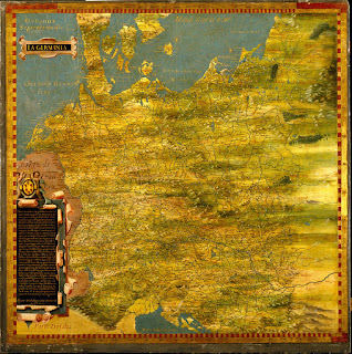
 |
| mapping helps you visualize your created world. |
One of the best parts for me in either writing or map-making is creating a new world. I can decide everything about it. It can also be daunting – trying to figure out landscapes, mountains, coastlines – especially when you don’t know where to start.
I personally always start with a land mass or continent. For the shape of this, check out actual countries and continents. Take note of how rugged or smooth the coastlines are and if there are islands. Drawing inspiration from real life creates a natural realism. Another great thing to try is searching for pictures of rust and using that shape as inspiration. Erosion works a similar way in both rust and land. You can also do this with a country, but country boarders are often affected by things other than natural causes (politics, for instance).
 |
| A basic land mass |
Next, I place mountains. Most simply, mountains form where two tectonic plates move against each other (so it may be a good idea to figure out where those plates are in your world and create mountains along those lines). They’re not random, and islands will typically follow this same line. Mountains can cause rainshadows (a dry area on the leeward side of the mountain), so if you want deserts, decide which direction the weather in your world comes from and put your desert on the protected side of your mountains.
 |
| Mountain placement is based on tectonic plates lying beneath them. |
After mountains, I start adding water. Some things to keep in mind here:
~Water flows toward the lowest point, away from mountains
~Rivers connect; they typically do not divide (unless there is a man-made reason, for instance)
~Lakes/ponds can have numerous rivers feeding them, but they can’t have more than one outgoing stream (as there is only one lowest point)
 |
| Rivers, flowing downhill from the mountains to the sea. |
After that, I add forests and start deciding where I want my cities to be.
 |
| Forests spring up once you have water sources |
 |
| People build where they have access to key resources. |
For me, as an artist, it helps if someone has something drawn out – to the best of their abilities – with details such as mountains, lakes, rivers, cities, etc. That way I can more or less copy their world and put my touches on it instead of creating it from scratch and hoping it matches their vision. So if you’re planning to have someone make a map for you, do your best to draw something out. (It can also help you learn about your world! Win-win!)
When creating a map of your world, keep your people groups/races in mind. This gets into more world-building stuff, but if most of your people are nomads, for instance, you likely wouldn’t have any big metropolitan type area. Or if your nation is a big farming nation, there likely won’t be a ton of mountains – it’ll be flatter land, more field-like.
The best advice I can give is to research geography and study maps! Look at real countries and note how the mountains cut across the land, how the rivers flow, how the coastline changes.
For further research, check out Brandon Sanderson’s World Building Geography lecture series
If you have any questions or would like to solicit my map-making services, you can contact me at my facebook site, Your World Designed.
Angie Grigaliunas is a fantasy writer (mature content and themes) and blogger. She loves Jesus, the woods, and the stars, and has always wanted to be a superhero with a secret identity. She lives in Ohio with her dear husband, their puppy, and their crazy cats. You can follow her on Twitter at @Angie_ZeWriter.
How might mapping your fictional world help you better understand it? Any questions for Angie?


Gosh I just loved this post! Great to meet you, Angie. I've been working with two separate artists, trying to develop a map for my middle grade series. How would you approach a map for more than one world? Ex: my MG encompasses some of Norse mythology and the nine worlds of Yggdrasil. Some action happens in Man's world - the girl's town - while other action travels them to different places within Yggdrasil. I'd appreciate any thoughts! Thank you...
ReplyDeleteHi! Thank you and nice to meet you too! I personally would make a map for every land/place they're in and have them all titled and everything. =)
DeleteAngie's multiple map plan make sense to me. Sounds like a really cool project, Sheri. Hope it's fun (rather than frustrating).
Delete